

Hurricane Harvey
Learn how you can help the people affected by Hurricane Harvey in Texas and along the Gulf Coast. Hurricane Harvey made landfall in Rockport, Texas at approximately 10:00 pm central…
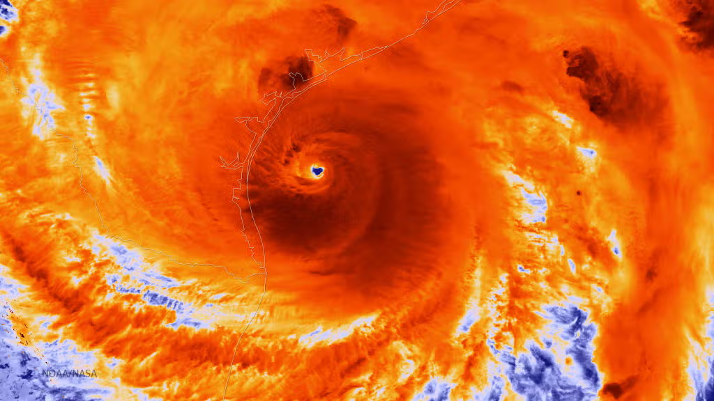
UNITED STATES – AUGUST 25: In this NOAA handout image, the NOAA/NASA Suomi NPP satellite captures this infrared image of Hurricane Harvey just prior to making landfall at 18:55 UTC on August 25, 2017 along the Texas coast. NOAA’s National Hurricane Center has clocked Harvey’s maximum sustained winds at 110 miles per hour with higher gusts. Infrared images like this one can help meteorologists identify the areas of the greatest intensity within large storm systems, such as the areas with the most intense convection, known as overshooting cloud tops (dark orange), surrounding the eye and along the outer bands. (Photo by NOAA via Getty Images)
NOAA via Getty ImagesLearn how you can help the people affected by Hurricane Harvey in Texas and along the Gulf Coast.
Hurricane Harvey made landfall in Rockport, Texas at approximately 10:00 pm central time Friday night and has caused widespread destruction and massive flooding the area has never seen. The remnants of Harvey continue to be a threat as the extremely dangerous flooding continues in Texas and parts of Louisiana. The devastating flood waters and closed roads has made rescue and relief efforts difficult. The American Red Cross is working around the clock to provide safe shelter for all of those who are impacted by this disaster.
If you wish to donate to the Red Cross to aid in relief efforts for Hurricane Harvey, you can text "HARVEY" to 90999 to make a one time donation of $10 which will be billed to your wireless bill.
You can also donate online at the link below: